


PINE, Benton County, Indiana
About
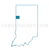
Outline

Summary
| Unique Area Identifier | 576424 |
| Name | PINE |
| County | Benton County |
| State | Indiana |
| Area (square miles) | 35.66 |
| Land Area (square miles) | 35.66 |
| Water Area (square miles) | 0.00 |
| % of Land Area | 100.00 |
| % of Water Area | 0.00 |
| Latitude of the Internal Point | 40.60601120 |
| Longtitude of the Internal Point | -87.15302680 |
Maps


Graphs
Select a template below for downloading or customizing gragh for PINE, Benton County, Indiana


Neighbors
Neighoring Voting District (by Name) Neighboring Voting District on the Map
- BOLIVAR, Benton County, IN
- CENTER EAST, Benton County, IN
- CENTER SOUTH, Benton County, IN
- GILBOA, Benton County, IN
- ROUND GROVE 1, White County, IN
- SHELBY 01, Tippecanoe County, IN
- UNION, Benton County, IN
- WEST POINT 1, White County, IN
Top 10 Neighboring County Subdivision (by Population) Neighboring County Subdivision on the Map
- Center township, Benton County, IN (2,757)
- Shelby township, Tippecanoe County, IN (2,352)
- Bolivar township, Benton County, IN (1,252)
- West Point township, White County, IN (381)
- Pine township, Benton County, IN (330)
- Round Grove township, White County, IN (259)
- Union township, Benton County, IN (255)
- Gilboa township, Benton County, IN (250)
Top 10 Neighboring Unified School District (by Population) Neighboring Unified School District on the Map
Top 10 Neighboring State Legislative District Lower Chamber (by Population) Neighboring State Legislative District Lower Chamber on the Map
Top 10 Neighboring State Legislative District Upper Chamber (by Population) Neighboring State Legislative District Upper Chamber on the Map
- State Senate District 6, IN (146,652)
- State Senate District 22, IN (144,531)
- State Senate District 7, IN (124,746)
Top 10 Neighboring 111th Congressional District (by Population) Neighboring 111th Congressional District on the Map
Top 10 Neighboring Census Tract (by Population) Neighboring Census Tract on the Map
- Census Tract 102.01, Tippecanoe County, IN (4,894)
- Census Tract 1001, Benton County, IN (3,413)
- Census Tract 1002, Benton County, IN (3,115)
- Census Tract 9583, White County, IN (2,405)
Top 10 Neighboring 5-Digit ZIP Code Tabulation Area (by Population) Neighboring 5-Digit ZIP Code Tabulation Area on the Map
- 47906, IN (66,972)
- 47944, IN (3,623)
- 47923, IN (3,494)
- 47977, IN (2,206)
- 47970, IN (2,034)
- 47971, IN (1,865)